Uncategorized files
Jump to navigation
Jump to search
Showing below up to 250 results in range #1 to #250.
View (previous 250 | next 250) (20 | 50 | 100 | 250 | 500)
 3D Set P15.png 899 × 893; 1 MB
 3D Set P15 Y120.png 899 × 893; 1.1 MB
 3D Set P15 Y120 R30 af.png 899 × 893; 1.17 MB
 3D Set P15 Y120 af.png 899 × 893; 1.1 MB
 3D Set P15 Y120 af close.png 899 × 893; 1.08 MB
 3D Set P90.png 899 × 893; 1.53 MB
 3d-tiles-24px.png 24 × 24; 327 bytes
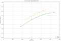
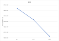
 All methods ssim comparison plot.png 1,264 × 855; 84 KB
 Antennapattern.png 495 × 511; 427 KB
 Aou.jpg 506 × 512; 41 KB
 Aperture.png 334 × 338; 207 KB
 Aspect colormap.png 349 × 229; 206 KB
 Auto follow area 2D.PNG 886 × 593; 973 KB
 Auto follow line 2D.PNG 886 × 593; 959 KB
 Auto follow none 2D.PNG 886 × 593; 977 KB
 Auto follow point 2D.PNG 886 × 593; 966 KB
 Auto follow point 3D.PNG 886 × 593; 941 KB
 Auto follow track 2D.PNG 886 × 593; 1.01 MB
 Auto follow track 3D.PNG 886 × 593; 900 KB
 Baseline image.png 375 × 341; 188 KB
 Basicmapclient.png 652 × 551; 533 KB
 Basicmapclientmap.png 786 × 443; 825 KB
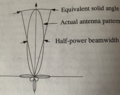 Beamwidth.png 364 × 287; 194 KB
 Bookmarknavigation.png 1,000 × 412; 431 KB
 Bookmarksdifferentsources.png 665 × 420; 172 KB
 Bookmarksmanagement.png 732 × 300; 176 KB
 Brush black 20x20.png 20 × 20; 302 bytes
 Cellformattedtext.png 561 × 484; 128 KB
 Changingmapsource.png 1,174 × 595; 847 KB
 Changingmapsublayers.png 1,277 × 595; 502 KB
 Citypop.png 1,127 × 796; 1.14 MB
 Colormap black 48px.png 48 × 48; 1 KB
 CombinedCoverage.png 513 × 481; 475 KB
 Compute results.png 557 × 640; 387 KB
 Createmapwnd.png 998 × 672; 99 KB
 Creatingmapclientwindow.png 1,037 × 1,088; 97 KB
 Cursorannotation.png 397 × 398; 149 KB
 Customclient.png 856 × 531; 776 KB
 Custominternalctrl.png 1,345 × 401; 232 KB
 Customstructure.png 491 × 491; 18 KB
 Customvisualization.png 1,443 × 400; 205 KB
 DNC fme public params.png 630 × 102; 9 KB
 DNC fme workspacerunner params.png 795 × 446; 20 KB
 DNC map preview.png 991 × 521; 428 KB
 Decoratedcers.png 332 × 321; 46 KB
 Decoratedcers selected.png 334 × 337; 45 KB
 Decoratedcircle.png 143 × 141; 7 KB
 Decoratedcircle selected.png 154 × 151; 8 KB
 Decoratedline.png 86 × 85; 4 KB
 Decoratedline selected.png 97 × 115; 5 KB
 Decoratedrectangle.png 368 × 224; 16 KB
 Decoratedrectangle selected.png 379 × 268; 23 KB
 Decoratedred.png 377 × 377; 48 KB
 Decoratedred selected.png 383 × 384; 42 KB
 DeygoutMKE.png 517 × 253; 30 KB
 DrawObjects 2D.PNG 886 × 593; 906 KB
 DrawObjects 3D.PNG 886 × 593; 859 KB
 Drawobjcolorschemes.png 1,265 × 544; 1.19 MB
 Drawobjcreate.png 886 × 893; 961 KB
 Drawobjects.png 624 × 466; 130 KB
 Drawobjedit.png 1,242 × 677; 717 KB
 Drawobjfiltering.png 648 × 258; 287 KB
 Drawobjmapcreate.png 525 × 350; 192 KB
 Drawobjremove.png 1,480 × 599; 874 KB
 Drawobjselect.png 1,773 × 895; 1.05 MB
 Drawobjsymbolscales.png 1,294 × 600; 1.34 MB
 Drawobjupdate.png 1,043 × 636; 1.14 MB
 E2dataset different res.png 1,021 × 718; 49 KB
 E2dataset steplargerthanres grid.png 1,021 × 718; 63 KB
 E2dataset steplargerthanres profile.png 1,021 × 718; 64 KB
 E2dataset steplessthanres grid.png 1,021 × 718; 48 KB
 E2dataset steplessthanres profile.png 1,021 × 605; 34 KB
 E2profile availabledataset.png 1,021 × 718; 696 KB
 E2profile clientarchitecture.png 945 × 945; 53 KB
 E2profile example.png 822 × 727; 605 KB
 E2profile example params.png 823 × 724; 612 KB
 E2profile servicearchitecture.png 983 × 756; 42 KB
 Ecw q89.png 375 × 341; 189 KB
 Ecw q90.png 375 × 341; 216 KB
 Ecw q99.png 375 × 342; 195 KB
 Ecw ssim077 q986.png 375 × 341; 204 KB
 Ecw ssim09 q95.png 375 × 341; 216 KB
 Ecw webp highcompression ssim comparison plot.png 1,260 × 855; 52 KB
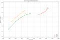 Ecw webp jpeg highcompression ssim comparison plot.png 1,264 × 855; 56 KB
 Elementhostcmp.png 1,088 × 857; 99 KB
 Elevation colormap.png 349 × 229; 149 KB
 Elevationanalysisclient.png 800 × 550; 684 KB
 Elevationobserverfslteration.png 1,006 × 550; 739 KB
 Elevationobservergenalteration.jpg 1,521 × 455; 362 KB
 Elevationobserverminmaxlteration.png 1,163 × 550; 1.01 MB
 Elevationobservers.png 800 × 550; 688 KB
 Elevationobservertool.jpg 1,525 × 488; 372 KB
 Elevationprofile enhanced.png 1,775 × 893; 996 KB
 Elevationprofile local.png 1,553 × 722; 685 KB
 Elevationprofile prepgui.png 832 × 653; 748 KB
 Elevationprofileclient.png 700 × 600; 473 KB
 Emptymapwithcontrols.png 786 × 443; 11 KB
 Enhanced elevationprofile.png 886 × 893; 908 KB
 FKB fme workspacerunner params.png 803 × 452; 18 KB
 FKB map preview.png 815 × 440; 496 KB
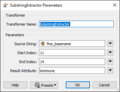 FME FKB substringextractor.PNG 363 × 277; 9 KB
 FeasibilityMonitoring.png 566 × 563; 247 KB
 Fencerule.png 361 × 326; 123 KB
 Fenceruleconditions.png 1,484 × 900; 1.48 MB
 Fencerulesremove.png 732 × 328; 128 KB
 Fmereader.png 393 × 257; 12 KB
 Fmewriter.png 392 × 264; 12 KB
 Footprint.png 1,920 × 1,040; 2.08 MB
 Footprints.png 580 × 568; 270 KB
 Format comparison baseline image.PNG 1,016 × 1,018; 2.22 MB
 Formsclosingevent.png 1,280 × 848; 118 KB
 Fps-graph.png 350 × 158; 63 KB
 Geofencedrawobjectmngt.png 736 × 493; 536 KB
 Geofencetrackmngt.png 736 × 493; 435 KB
 Geofencingclient.png 1,397 × 900; 900 KB
 Geofencingdatasourceoverview.png 960 × 720; 7 KB
 Geofencingruleexecution.png 960 × 720; 26 KB
 Geofencingserviceoverview.png 960 × 720; 9 KB
 Globe-2D.PNG 967 × 893; 1.68 MB
 Globe-3D.PNG 967 × 893; 1,023 KB
 Globe First-2D.PNG 886 × 593; 743 KB
 Globe First-3D.PNG 886 × 593; 620 KB
 Grid draw object.png 1,728 × 1,217; 1.51 MB
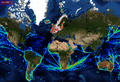 Heatmap global tracks.png 1,369 × 939; 2.43 MB
 Heatmap overview.png 556 × 420; 457 KB
 Heatmapclasses.png 1,305 × 360; 24 KB
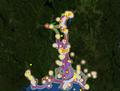
 Heatmappoi.png 1,279 × 939; 1.53 MB
 Ic layers black 24dp 1x.png 24 × 24; 317 bytes
 Ic layers black 24dp 2x.png 48 × 48; 521 bytes
 Ic map black 24dp 1x.png 24 × 24; 222 bytes
 Ic map black 24dp 2x.png 48 × 48; 363 bytes
 Ic terrain black 24dp 1x.png 24 × 24; 175 bytes
 Installpackgmgr.png 836 × 450; 77 KB
 Interpolationmethods.png 593 × 1,684; 619 KB
 Jpeg q100.jpeg 1,600 × 1,200; 1.53 MB
 Jpeg q10 corrected.png 375 × 342; 89 KB
 Jpeg ssim077 q10.png 375 × 341; 89 KB
 Jpeg ssim09 q25.png 375 × 341; 150 KB
 Layervisibility.png 1,524 × 681; 1.09 MB
 M3-3d-tiles-48px.png 48 × 48; 481 bytes
 M3-Geoloc-black-32px.png 32 × 32; 836 bytes
 M3-Routing db.png 24 × 24; 529 bytes
 M3 3d tileset submodel.PNG 405 × 435; 9 KB
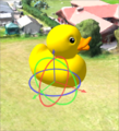 M3 3dtiles duck widget.PNG 398 × 439; 393 KB
 M3 3dtiles model properties.PNG 1,377 × 877; 1.01 MB
 M3 TMS layer.png 1,470 × 924; 488 KB
 M3 WMS layer.png 1,470 × 924; 1.28 MB
 M3 add layer window.png 784 × 436; 32 KB
 M3 basemap dynamic layer.png 784 × 895; 41 KB
 M3 basemap dynamic layer black.png 789 × 762; 49 KB
 M3 color palette.png 802 × 736; 38 KB
 M3 colormap datasource all.png 803 × 265; 13 KB
 M3 colormap datasource specific.png 803 × 554; 26 KB
 M3 colormap datasource tags.png 804 × 314; 15 KB
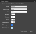
 M3 create color palette.png 442 × 351; 9 KB
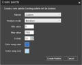
 M3 create palette.png 442 × 416; 12 KB
 M3 dataset update.png 404 × 335; 10 KB
 M3 draft black.png 48 × 37; 970 bytes
 M3 duplicate vector dataset.png 403 × 372; 16 KB
 M3 elevation distance tool.png 913 × 774; 59 KB
 M3 elevation shading.png 913 × 774; 450 KB
 M3 gettingstarted finished.png 1,366 × 839; 296 KB
 M3 gettingstarted overlay.png 610 × 452; 28 KB
 M3 gettingstarted product.png 599 × 422; 18 KB
 M3 identify features.png 800 × 738; 222 KB
 M3 import 3DTiles.PNG 354 × 504; 14 KB
 M3 import elevation 16bit black.png 350 × 438; 10 KB
 M3 import elevation 32bit black.png 351 × 408; 10 KB
 M3 import elevationdata 16bit.png 350 × 397; 10 KB
 M3 import elevationdata 32bit.png 350 × 369; 10 KB
 M3 import full app.png 1,229 × 852; 158 KB
 M3 import rasterdata.png 352 × 539; 13 KB
 M3 import vectordata.png 351 × 721; 17 KB
 M3 import vectordata black.png 354 × 880; 20 KB
 M3 import vectordata finished review.png 402 × 303; 7 KB
 M3 import vectordata finished review black.png 462 × 343; 12 KB
 M3 import vectordata review.png 351 × 722; 24 KB
 M3 import vectordata review black.png 353 × 884; 29 KB
 M3 layers advanced properties metadata.png 885 × 763; 79 KB
 M3 layers advanced properties metadata black.png 890 × 794; 48 KB
 M3 layers scale selector.png 487 × 762; 31 KB
 M3 layers scale selector advanced properties.png 887 × 761; 42 KB
 M3 layers scale selector advanced properties black.png 890 × 743; 38 KB
 M3 locationimport geonames.PNG 352 × 379; 9 KB
 M3 logo full black68.png 68 × 68; 5 KB
 M3 logo full white outline 128.png 128 × 128; 14 KB
 M3 logo text dark.png 607 × 123; 19 KB
 M3 map imported added to basemap.png 1,371 × 852; 279 KB
 M3 map rightclick.png 485 × 560; 142 KB
 M3 mapbox style repeating pattern.png 652 × 373; 69 KB
 M3 mapbox vectorstyle filters.png 401 × 752; 47 KB
 M3 mapimport geopackage simple.png 352 × 387; 9 KB
 M3 mapimport maptaskqueue.png 600 × 468; 22 KB
 M3 mapimport placeholder layer.png 1,229 × 852; 323 KB
 M3 mapimport raster temp layer icon.PNG 25 × 32; 434 bytes
 M3 mapimport routingDB.PNG 350 × 960; 24 KB
 M3 mapimport temp layer.PNG 490 × 291; 15 KB
 M3 maptools location.png 1,054 × 642; 60 KB
 M3 multiple styles in overlay.png 818 × 484; 50 KB
 M3 overlay tag.png 492 × 832; 30 KB
 M3 overlay tag black.png 489 × 760; 24 KB
 M3 overview.png 832 × 567; 53 KB
 M3 product contents add content.png 488 × 338; 19 KB
 M3 product contents add content black.png 487 × 365; 17 KB
 M3 product dependencies.png 876 × 336; 23 KB
 M3 product metadata.png 400 × 713; 133 KB
 M3 product metadata black.png 489 × 826; 98 KB
 M3 rasterimport benchmark ECWInnlandet.png 2,019 × 1,394; 27 KB
 M3 rasterimport benchmark N2000.png 2,020 × 1,393; 25 KB
 M3 rasterimport benchmark N50.png 2,019 × 1,393; 24 KB
 M3 rasterimport nodata checked.PNG 352 × 512; 12 KB
 M3 rasterlayer appearance.PNG 798 × 456; 37 KB
 M3 rasterlayer appearance linear.PNG 383 × 369; 85 KB
 M3 rasterlayer appearance nearest.PNG 383 × 369; 7 KB
 M3 released black.png 48 × 38; 974 bytes
 M3 settings elevation datasets.PNG 435 × 309; 12 KB
 M3 settings map.PNG 377 × 365; 11 KB
 M3 settings workspaces.png 614 × 420; 22 KB
 M3 simple raster import.PNG 376 × 299; 13 KB
 M3 tiles export.png 656 × 767; 279 KB
 M3 tiles export gdk 4.3.png 669 × 638; 254 KB
 M3 vector label.png 1,250 × 922; 312 KB
 M3 vector styling areas outline.png 1,709 × 1,052; 370 KB
 M3 vector styling lines.png 1,577 × 1,052; 411 KB
 M3 vector styling lines newcolor.png 1,709 × 1,052; 445 KB
 M3 vector styling points.png 1,709 × 1,052; 333 KB
 M3 vector styling points SVG.png 1,709 × 1,052; 553 KB
 M3 vector styling workflow.PNG 697 × 396; 22 KB
 M3 vectorimport mbtiles.PNG 374 × 712; 32 KB
 M3 vectorlayer attributes.png 888 × 1,049; 165 KB
 M3 vectorstyle fanout dialog.PNG 440 × 296; 8 KB
 M3 vectorstyle fanout group.PNG 361 × 296; 72 KB
 M3 vectorstyle filters.PNG 399 × 479; 88 KB
 M3 vectorstyle group layers.PNG 389 × 296; 51 KB
 M3 vectorstyle label.PNG 399 × 538; 50 KB
 M3 vectorstyle layerlist.PNG 802 × 839; 106 KB
 M3 vectorstyle overzoom.PNG 803 × 372; 25 KB
 M3 vectorstyle zoom selector.PNG 383 × 107; 4 KB
 M3 vectorstyle zoomstops.PNG 402 × 563; 52 KB
 M3 weblayer openstreetmap.png 1,470 × 924; 803 KB
 M3 workspace tree view.png 485 × 543; 22 KB
 M3 workspace tree view black.png 469 × 535; 17 KB
 MIconLineLayer48.png 48 × 48; 1 KB
 MIconPointLayer48.png 48 × 48; 710 bytes
 MIconPolygonLayer48.png 48 × 48; 2 KB
 Managenavigationctrls.png 1,178 × 593; 472 KB
 Managenugetpackages.png 421 × 352; 14 KB
 Map.png 564 × 574; 536 KB
 Map Alt 2D.PNG 886 × 703; 262 KB
 Map Alt 3D.PNG 886 × 703; 442 KB


