Web layers: Difference between revisions
(Created page with "none There are four types of web layers available in Maria GDK and M3: * [http://www.opengeospatial.org/standards/wms Web Map Service] * [http://ww...") |
No edit summary |
||
| Line 1: | Line 1: | ||
[[File:web map layer.png|none]] There are | [[File:web map layer.png|none]] There are three types of web layers available in Maria GDK and M3: | ||
* [http://www.opengeospatial.org/standards/wms Web Map Service] | * [http://www.opengeospatial.org/standards/wms Web Map Service] | ||
* [http://www.opengeospatial.org/standards/wmts Web Map Tile Service] | * [http://www.opengeospatial.org/standards/wmts Web Map Tile Service] | ||
* [https://wiki.osgeo.org/wiki/Tile_Map_Service_Specification Tile Map Service] | * [https://wiki.osgeo.org/wiki/Tile_Map_Service_Specification Tile Map Service] | ||
== WM(T)S == | == WM(T)S == | ||
| Line 20: | Line 20: | ||
A Tile Map Service layer does not have sublayers, so setup is minimal. You need to provide a URL to the tiles with X,Y and zoom level placeholders, for instance <code>https://tile.waymarkedtrails.org/hiking/{z}/{x}/{y}.png</code>. If the server provides it, you can also enter a comma-separated list of subdomains (often "a,b,c") [[File:M3 TMS layer.png|none|900px|TMS layer]] | A Tile Map Service layer does not have sublayers, so setup is minimal. You need to provide a URL to the tiles with X,Y and zoom level placeholders, for instance <code>https://tile.waymarkedtrails.org/hiking/{z}/{x}/{y}.png</code>. If the server provides it, you can also enter a comma-separated list of subdomains (often "a,b,c") [[File:M3 TMS layer.png|none|900px|TMS layer]] | ||
[[Category:Maria Map Maker]] | [[Category:Maria Map Maker]] | ||
Revision as of 13:31, 6 May 2021
There are three types of web layers available in Maria GDK and M3:
WM(T)S
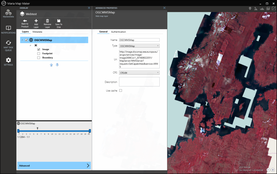
The WMS and WMTS layers are similar in setup in M3. Both require you to set the address of the service (Uri) and the coordinate system (CRS for WMS, Tile matrix set for WMTS). The layer can then be expanded and you can view the sublayers provided by the service. For WMS you can select any number of sublayers, while in the WMTS layer you can only select one at a time.
You need to use Save to disk for changes to be visible in the map.
The Authentication tab lets you input credentials if needed.
TMS
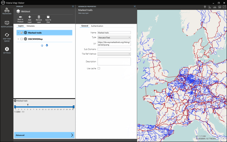
A Tile Map Service layer does not have sublayers, so setup is minimal. You need to provide a URL to the tiles with X,Y and zoom level placeholders, for instance https://tile.waymarkedtrails.org/hiking/{z}/{x}/{y}.png. If the server provides it, you can also enter a comma-separated list of subdomains (often "a,b,c")

