Maria globe client: Difference between revisions

From Maria GDK Wiki
Jump to navigation Jump to search
()
()
 
(131 intermediate revisions by 2 users not shown)
Line 1: Line 1:
This page describes how to create a Maria GDK map client utilising '''''MariaGlobeMapControl''''' with 2D and 3D visualisation of map, tracks and draw objects.
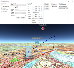
[[File:Globe-3D.PNG|right|thumb|Maria Globe Client]]


[[File:Globe-3D.PNG|right|thumb|Maria Globe Client]]
These pages describe how to create a Maria GDK map client utilising '''''MariaGlobeMapControl''''' with 2D and 3D visualisation of map, tracks and draw objects.


== General ==
== General ==


* You will need to include the following NuGet package:
; Note
** '''''TPG.Maria.MariaGlobeMapControl''''' (Currently available Teleplan Globe internal only)
:* You will need to include the '''''TPG.MariaGDK3D''''' NuGet package. (Currently available Teleplan Globe internal only)
 
:: For more info, see [[Development requirements#Loading Maria GDK Packages| Loading Maria GDK, NuGet Packages]]
* Sample code is found in the '''''MariaGlobeClient''''' project, in the '''''Sample Projects''''' solution.  
:* Sample code is found in the '''''MariaGlobeClient''''' project, in the '''''Sample Projects''''' solution.  
** Note that the sample code is specifying the service connections in ''code'', and not by '''''app.config'''''.
:* Note that the sample code is specifying the service connections in ''code'', and not by '''''app.config'''''.
 
:* For general troubleshooting, see [[Development_troubleshooting|Development troubleshooting]]
== Utilising the globe control ==
 
=== Including MariaGlobeMapControl ===
 
Create a WPF Application, and add reference to the '''''TPG.Maria.MariaGlobeMapControl''''' package. <br/>
For NuGet details, see ''[[Basic map client|Maria Basic Map Client]]''.
 
Add the '''''MariaGlobeMapControl''''' to the Main window xaml.
 
<source lang="xml">
<Window x:Class="MariaGlobeClient.MainWindow"
        . . .
        Title="MariaGlobeClient" Height="600" Width="600">
    <Grid>
        <MariaGlobeMapControl x:Name="MariaGlobeCtrl" Background="#E9ECFA"                     
                    Layers="{Binding Layers}"
                    MiniMapLayer="{Binding MapViewModel.MiniMapLayer, Mode=OneWay}"
                    CenterScale="{Binding MapViewModel.CenterScale}"
                    CenterPosition="{Binding MapViewModel.CenterPosition}"
                    MouseMoveDistanceToStartTracking="0"
                    ZoomOnDblClick="False"
                    DegreeToLockRotateAndScale="2"
                    PercentageToLockScaleOnly="2.0"
                    Is3DMode="False"
                    IsRulerVisible="True"
                    IsCenterPositionIndicatorEnabled="True"
                    IsMiniMapVisible="True" />
    </Grid>
</Window>
</source>
 
=== Add view models ===
 
* Add a view model class (''MainViewModel'') for communication with the Maria component, and another (''MapViewModel'') for map handling. Both including inheritance of '''''ViewModelBase''''', for details see [[Map_interaction_client/Prepare_your_application_for_interactions|''Prepare your application for interactions'']].
 
* Set the data context of your client window to the '''''MainViewModel''''', and implement an event handler for the '''''WindowClosing''''' event. For details see [[Basic map client|Maria Basic Map Client]].
 
==== MainViewModel ====
 
Extend the inheritances to include the '''''IMariaGlobeMapViewModel''''' and implement the interface.
 
<source lang="c#">
public class MainViewModel : ViewModelBase, IMariaGlobeMapViewModel
{
    public IGlobeMapManager GlobeMapManager { get; }
    public IDrawObjectLayerFactory DrawObjectLayerFactory { get; private set; }
    public IGlobeMapViewModel GlobeMapViewModel { get; set; }
...
</source>
 
Add the following fields and properties:
 
<source lang="c#">
. . .
    private IMariaMapLayer _mapLayer;
    private IMariaMapLayer _miniMapLayer;
 
    public MapViewModel MapViewModel { get; }
    public ObservableCollection<IMariaLayer> Layers { get; set; }
. . .
</source>
 
In the constructor:
* initialise the Layer property
* set up the map services
* create the GlobeMapManager
* create map layer, mini-map layer and add to the '''''Layers''''' property
* instanciate the MapViewModel
 
 
<source lang="c#">
...
public MainViewModel()
{
    Layers = new ObservableCollection<IMariaLayer>();
 
    IBindingFactory bindingFactory = new BindingFactory();
    IEndpointAddressFactory endpointAddressFactory = new EndpointAddressFactory();
 
    // Set up template client
    var mapTemplateServiceClient = new MapTemplateServiceClientFactory(
        bindingFactory,
        endpointAddressFactory).New("http://tpg-geostore:9008/maptemplates", BindingType.BasicHttp);
 
    // Set up catalog service client and connect to service
    var mapCatalogServiceClient = new MapCatalogServiceClient(
        bindingFactory.New(BindingType.BasicHttp),
        endpointAddressFactory.New("http://tpg-geostore:9008/catalog"));
 
    GlobeMapManager = new GlobeMapManager(mapCatalogServiceClient, mapTemplateServiceClient);
    GlobeMapManager.TileCacheManager.MaxCacheSize = 250;
 
    _mapLayer = new MapLayer(GlobeMapManager);
    _miniMapLayer = new MapLayer(GlobeMapManager);
    Layers.Add(_mapLayer);
 
    MapViewModel = new MapViewModel(_mapLayer, _miniMapLayer);
}
 
</source>
 
Make the class disposable by including and implementing  '''''IDisposable'''''.
 
<source lang="c#">
...
public class MainViewModel : ViewModelBase, IMariaGlobeMapViewModel, IDisposable
{
...
    public void Dispose()
    {
        _mapLayer?.Dispose();
        _miniMapLayer?.Dispose();
        GlobeMapViewModel?.Dispose();
    }
</source>
 
==== MapViewModel ====
 
Add the following fields and properties:
 
<source lang="c#">
...
    private readonly IMariaMapLayer _mapLayer;
 
    public IMariaMapLayer MiniMapLayer { get; private set; }
    public GeoPos CenterPosition { get; set; }     
    public double CenterScale { get; set; }
...
</source>
 
Create a constructor, taking map layer and and mini-map layer as parameters and initialising map and mini-map event handling.
 
<source lang="c#">
public MapViewModel(IMariaMapLayer mapLayer, IMariaMapLayer miniMapLayer)
{
    _mapLayer = mapLayer;
 
    if (_mapLayer != null)
        _mapLayer.LayerInitialized += OnMapLayerInitialized;
 
    MiniMapLayer = miniMapLayer;
    if (MiniMapLayer != null)
        MiniMapLayer.LayerInitialized += OnMiniMapLayerInitialized;
}
</source>
 
Implement the '''''LayerInitialized''''' event handlers for the map and mini map.
 
<source lang="c#">
...
    private void OnMapLayerInitialized()
    {
        CenterPosition = new GeoPos(59.908358, 10.628190); // TPG - Lysaker
        CenterScale = 1000000;
 
        _mapLayer.ActiveMapTemplate = _mapLayer.ActiveMapTemplates.Any() ? _mapLayer.ActiveMapTemplates.First() : null;
    }
 
    private void OnMiniMapLayerInitialized()
    {
        MiniMapLayer.ActiveMapTemplate = _mapLayer.ActiveMapTemplates.Any() ? _mapLayer.ActiveMapTemplates.First() : null;
    }
...
</source>
 
=== Running the globe client ===
 
Running your application, the window area should now include 2D map information and mini map - and you should be able to navigate the map!
 
[[File:Globe_First-2D.PNG|none|frame|Globe client with 2D map]]
 
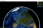
To start the globe client in #D mode, Change the '''''Is3DMode''''' property of the '''''MariaGlobeMapControl''''' to ''True'', and start the application again.<br>
 
The window area should now include 3D map information - and you should be able to navigate the 3D-map!
 
 
[[File:Globe_First-3D.PNG|none|frame|Globe client with 3D map]]
 
== Globe interaction ==
 
=== Map interaction ===
 
==== Map utilities ====
The different map utilities can be turned on/off programatically e.g. through User controlls.
 
Here is an example of adding check boxes with direct binding to the '''''MariaGlobeMapControl''''' from your main window.
 
<source lang="xml">
...
 
To be described ...
 
...
</source>
 
==== Map settings ====


<source lang="xml">
...


To be described ...
== Sections ==
;The following main topics are handled:


...
{| class="wikitable"
</source>
|-
|
;1. [[Maria_globe_client/Utilising_the_globe_control|Utilising the globe control]]
|
[[File:Globe_First-3D.PNG|150px|link=Maria_globe_client/Utilising_the_globe_control]]
|-
|
;2. [[Maria_globe_client/Map_interaction|Map interaction]]
|
[[File:Map_Pref_3D.PNG|150px|link=Maria_globe_client/Map_interaction]]
|-
|
;3. [[Maria_globe_client/Draw_object_interaction|Draw object interaction]]
|
[[File:DrawObjects_3D.PNG|150px|link=Maria_globe_client/Draw_object_interaction]]
|-
|
;4. [[Maria_globe_client/Track_interaction|Track interaction]]
|
[[File:Track_3D.PNG|150px|link=Maria_globe_client/Track_interaction]]
|-
|
;5. [[Maria_globe_client/Auto_follow|Auto follow]]
|
[[File:Auto_follow_track_3D.PNG|150px|link=Maria_globe_client/Auto_follow]]
|-
|
;6. [[Maria_globe_client/Advanced_map_settings|Advanced map settings]]
|
[[File:3D_Set_P15_Y120_R30_af.png|150px|link=Maria_globe_client/Advanced_map_settings]]
|}


=== Track interaction ===


=== Draw object interaction ===


=== Autofollow ===
[[Category:Creating applications]]
=== Monitoring service connections ===

Latest revision as of 14:58, 28 October 2019

Maria Globe Client

These pages describe how to create a Maria GDK map client utilising MariaGlobeMapControl with 2D and 3D visualisation of map, tracks and draw objects.

General

Note
  • You will need to include the TPG.MariaGDK3D NuGet package. (Currently available Teleplan Globe internal only)
For more info, see Loading Maria GDK, NuGet Packages
  • Sample code is found in the MariaGlobeClient project, in the Sample Projects solution.
  • Note that the sample code is specifying the service connections in code, and not by app.config.
  • For general troubleshooting, see Development troubleshooting

Sections

The following main topics are handled
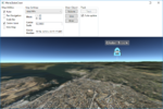
1. Utilising the globe control

Globe First-3D.PNG

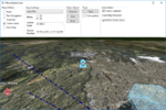
2. Map interaction

Map Pref 3D.PNG

3. Draw object interaction

DrawObjects 3D.PNG

4. Track interaction

Track 3D.PNG

5. Auto follow

Auto follow track 3D.PNG

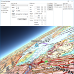
6. Advanced map settings

3D Set P15 Y120 R30 af.png