Maria globe client: Difference between revisions

From Maria GDK Wiki
Jump to navigation Jump to search
()
()
 
(95 intermediate revisions by 2 users not shown)
Line 1: Line 1:
This page describes how to create a Maria GDK map client utilising '''''MariaGlobeMapControl''''' with 2D and 3D visualisation of map, tracks and draw objects.
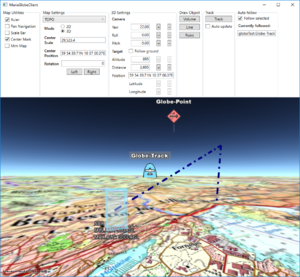
[[File:Globe-3D.PNG|right|thumb|Maria Globe Client]]


[[File:Globe-3D.PNG|right|thumb|Maria Globe Client]]
These pages describe how to create a Maria GDK map client utilising '''''MariaGlobeMapControl''''' with 2D and 3D visualisation of map, tracks and draw objects.


== General ==
== General ==


'''''<pre style="color: orange">This page is under construction!</pre>'''''
; Note
 
:* You will need to include the '''''TPG.MariaGDK3D''''' NuGet package. (Currently available Teleplan Globe internal only)
* You will need to include the following NuGet package:
:: For more info, see [[Development requirements#Loading Maria GDK Packages| Loading Maria GDK, NuGet Packages]]
** '''''TPG.Maria.MariaGlobeMapControl''''' (Currently available Teleplan Globe internal only)
:* Sample code is found in the '''''MariaGlobeClient''''' project, in the '''''Sample Projects''''' solution.  
 
:* Note that the sample code is specifying the service connections in ''code'', and not by '''''app.config'''''.
* Sample code is found in the '''''MariaGlobeClient''''' project, in the '''''Sample Projects''''' solution.  
:* For general troubleshooting, see [[Development_troubleshooting|Development troubleshooting]]
** Note that the sample code is specifying the service connections in ''code'', and not by '''''app.config'''''.
 
== Utilising the globe control ==
 
=== Including MariaGlobeMapControl ===
 
Create a WPF Application, and add reference to the '''''TPG.Maria.MariaGlobeMapControl''''' package. <br/>
For NuGet details, see ''[[Basic map client|Maria Basic Map Client]]''.
 
Add the '''''MariaGlobeMapControl''''' to the Main window xaml.
 
<source lang="xml">
<Window x:Class="MariaGlobeClient.MainWindow"
        . . .
        Title="MariaGlobeClient" Height="600" Width="600">
    <Grid>
        <MariaGlobeMapControl x:Name="MariaGlobeCtrl" Background="#E9ECFA"                     
                    Layers="{Binding Layers}"
                    MiniMapLayer="{Binding MapViewModel.MiniMapLayer, Mode=OneWay}"
                    CenterScale="{Binding MapViewModel.CenterScale}"
                    CenterPosition="{Binding MapViewModel.CenterPosition}"
                    MouseMoveDistanceToStartTracking="0"
                    ZoomOnDblClick="False"
                    DegreeToLockRotateAndScale="2"
                    PercentageToLockScaleOnly="2.0"
                    Is3DMode="False"
                    IsRulerVisible="True"
                    IsCenterPositionIndicatorEnabled="True"
                    IsMiniMapVisible="True" />
    </Grid>
</Window>
</source>
 
=== Add view models ===
 
* Add a view model class (''MainViewModel'') for communication with the Maria component, and another (''MapViewModel'') for map handling. Both including inheritance of '''''ViewModelBase''''', for details see [[Map_interaction_client/Prepare_your_application_for_interactions|''Prepare your application for interactions'']].
 
* Set the data context of your client window to the '''''MainViewModel''''', and implement an event handler for the '''''WindowClosing''''' event. For details see [[Basic map client|Maria Basic Map Client]].
 
==== MainViewModel ====
 
Extend the inheritances to include the '''''IMariaGlobeMapViewModel''''' and implement the interface.
 
<source lang="c#">
public class MainViewModel : ViewModelBase, IMariaGlobeMapViewModel
{
    public IGlobeMapManager GlobeMapManager { get; }
    public IDrawObjectLayerFactory DrawObjectLayerFactory { get; private set; }
    public IGlobeMapViewModel GlobeMapViewModel { get; set; }
...
</source>
 
Add the following fields and properties:
 
<source lang="c#">
. . .
    private IMariaMapLayer _mapLayer;
    private IMariaMapLayer _miniMapLayer;
 
    public MapViewModel MapViewModel { get; }
    public ObservableCollection<IMariaLayer> Layers { get; set; }
. . .
</source>
 
In the constructor:
* initialise the Layer property
* set up the map services
* create the GlobeMapManager
* create map layer, mini-map layer and add to the '''''Layers''''' property
* instanciate the MapViewModel
 
 
<source lang="c#">
...
public MainViewModel()
{
    Layers = new ObservableCollection<IMariaLayer>();
 
    IBindingFactory bindingFactory = new BindingFactory();
    IEndpointAddressFactory endpointAddressFactory = new EndpointAddressFactory();
 
    // Set up template client
    var mapTemplateServiceClient = new MapTemplateServiceClientFactory(
        bindingFactory,
        endpointAddressFactory).New("http://tpg-mariagdktest:9008/maptemplates", BindingType.BasicHttp);
 
    // Set up catalog service client and connect to service
    var mapCatalogServiceClient = new MapCatalogServiceClient(
        bindingFactory.New(BindingType.BasicHttp),
        endpointAddressFactory.New("http://tpg-mariagdktest:9008/catalog"));
 
    GlobeMapManager = new GlobeMapManager(mapCatalogServiceClient, mapTemplateServiceClient);
    GlobeMapManager.TileCacheManager.MaxCacheSize = 250;
 
    _mapLayer = new MapLayer(GlobeMapManager);
    _miniMapLayer = new MapLayer(GlobeMapManager);
    Layers.Add(_mapLayer);
 
    MapViewModel = new MapViewModel(_mapLayer, _miniMapLayer);
}
 
</source>
 
Make the class disposable by including and implementing  '''''IDisposable'''''.
 
<source lang="c#">
...
public class MainViewModel : ViewModelBase, IMariaGlobeMapViewModel, IDisposable
{
...
    public void Dispose()
    {
        _mapLayer?.Dispose();
        _miniMapLayer?.Dispose();
        GlobeMapViewModel?.Dispose();
    }
</source>
 
==== MapViewModel ====
 
Add the following fields and properties:
 
<source lang="c#">
...
    private readonly IMariaMapLayer _mapLayer;
 
    public IMariaMapLayer MiniMapLayer { get; private set; }
    public GeoPos CenterPosition { get; set; }     
    public double CenterScale { get; set; }
...
</source>
 
Create a constructor, taking map layer and and mini-map layer as parameters and initialising map and mini-map event handling.
 
<source lang="c#">
public MapViewModel(IMariaMapLayer mapLayer, IMariaMapLayer miniMapLayer)
{
    _mapLayer = mapLayer;
 
    if (_mapLayer != null)
        _mapLayer.LayerInitialized += OnMapLayerInitialized;
 
    MiniMapLayer = miniMapLayer;
    if (MiniMapLayer != null)
        MiniMapLayer.LayerInitialized += OnMiniMapLayerInitialized;
}
</source>
 
Implement the '''''LayerInitialized''''' event handlers for the map and mini map.
 
<source lang="c#">
...
    private void OnMapLayerInitialized()
    {
        CenterPosition = new GeoPos(59.908358, 10.628190); // TPG - Lysaker
        CenterScale = 500000;
 
        _mapLayer.ActiveMapTemplate = _mapLayer.ActiveMapTemplates.Any() ? _mapLayer.ActiveMapTemplates.First() : null;
    }
 
    private void OnMiniMapLayerInitialized()
    {
        MiniMapLayer.ActiveMapTemplate = _mapLayer.ActiveMapTemplates.Any() ? _mapLayer.ActiveMapTemplates.First() : null;
    }
...
</source>
 
=== Running the globe client ===
 
Running your application, the window area should now include 2D map information and mini map - and you should be able to navigate the map!
 
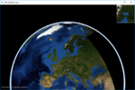
[[File:Globe_First-2D.PNG|none|frame|Globe client with 2D map]]
 
To start the globe client in #D mode, Change the '''''Is3DMode''''' property of the '''''MariaGlobeMapControl''''' to ''True'', and start the application again.<br>
 
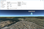
The window area should now include 3D map information - and you should be able to navigate the 3D-map!
 
 
[[File:Globe_First-3D.PNG|none|frame|Globe client with 3D map]]
 
== Globe interaction ==
 
=== Map interaction ===
 
==== Map utilities ====
The different map utilities can be turned on/off programatically e.g. through User controlls.
 
Here is an example of adding check boxes with direct binding to the '''''MariaGlobeMapControl''''' from your main window.
 
<source lang="xml">
...
<Grid>
    <Grid.RowDefinitions>
        <RowDefinition Height="auto"/>
        <RowDefinition Height="*"/>
    </Grid.RowDefinitions>
    <StackPanel Grid.Row="0" Orientation="Horizontal"
                Visibility="Visible">
        <GroupBox Header="Map Utilities">
            <StackPanel Orientation="Vertical" Visibility="Visible" Margin="5">
                <CheckBox Content="Ruler" Margin="3"
                          ToolTip="Ruler"
                          IsChecked="{Binding IsRulerVisible, ElementName=MariaGlobeCtrl}" />
                <CheckBox Content="Pan Navigation" Margin="3"
                          ToolTip="Pan Navigation"
                          IsChecked="{Binding IsPanNavigationVisible, ElementName=MariaGlobeCtrl}" />
                <CheckBox Content="Scale Bar" Margin="3"
                          ToolTip="Center Position, Scale Bar"
                          IsChecked="{Binding IsScaleBarVisible, ElementName=MariaGlobeCtrl}" />
                <CheckBox Content="Center Mark"  Margin="3"
                          ToolTip="Center Position Indicator"
                          IsChecked="{Binding IsCenterPositionIndicatorEnabled, ElementName=MariaGlobeCtrl}" />
                <CheckBox Content="Mini Map" Margin="3"
                          ToolTip="Mini Map"
                          IsChecked="{Binding IsMiniMapVisible, ElementName=MariaGlobeCtrl}" />                 
            </StackPanel>
        </GroupBox>
    </StackPanel>
    <Grid Grid.Row="1">
        <mariaglobemapcontrol:MariaGlobeMapControl x:Name="MariaGlobeCtrl"
                                                  Background="#E9ECFA"                                                 
                                                  Layers="{Binding Layers}"
                                                  MiniMapLayer="{Binding MapViewModel.MiniMapLayer, Mode=OneWay}"
                                                  CenterScale="{Binding MapViewModel.CenterScale}"
                                                  CenterPosition="{Binding MapViewModel.CenterPosition}"
                                                  Is3DMode="False"
                                                  MouseMoveDistanceToStartTracking="0"
                                                  ZoomOnDblClick="False"
                                                  DegreeToLockRotateAndScale="2"
                                                  PercentageToLockScaleOnly="2.0"
                                                  IsRulerVisible="True"
                                                  IsCenterPositionIndicatorEnabled="True"
                                                  IsMiniMapVisible="True" />
    </Grid>
</Grid>
...
</source>
 
==== Map settings ====
 
Your map service will most likely contain different map templates, and you would like to select the template to be used.<br>
In we will create a list of templates to chose from, display the current center position and scale, and also choose the display mode - 2D or 3D.
 
Add the following to your Main Window XAML:
 
<source lang="xml">
...
<GroupBox Header="Map Settings">
    <Grid Margin="3">
        <Grid.RowDefinitions>
            <RowDefinition Height="auto" />
            <RowDefinition Height="auto" />
            <RowDefinition Height="auto" />
            <RowDefinition Height="auto" />                     
        </Grid.RowDefinitions>
        <Grid.ColumnDefinitions>
            <ColumnDefinition Width="auto"/>
            <ColumnDefinition Width="*"/>
        </Grid.ColumnDefinitions>
        <ComboBox Name="cmbActiveMap" Grid.Row="0" Grid.Column="0" Grid.ColumnSpan="2" Margin="0,0,0,5"
                  Width="Auto" Height="Auto" MinWidth="200"
                  VerticalAlignment="Top"
                  ItemsSource="{Binding MapViewModel.AvailableMapTemplateNames}"
                  SelectedItem="{Binding MapViewModel.ActiveMapTemplateName}"
                  IsSynchronizedWithCurrentItem="true" />
 
        <Label Grid.Row="1" Grid.Column="0"
              Content="Mode" FontWeight="DemiBold"/>
        <StackPanel Grid.Row="1" Grid.Column="1">
            <RadioButton Name="Btn2D"
                        Content="2D"
                        IsChecked="True"
                        Command="{Binding Set2DModeCommand, ElementName=MariaGlobeCtrl}" />
            <RadioButton Name="Btn3D"
                        Content="3D"                                     
                        Command="{Binding Set3DModeCommand, ElementName=MariaGlobeCtrl}" />
        </StackPanel>
 
        <Label Grid.Row="2" Grid.Column="0"  FontWeight="DemiBold">
            <TextBlock>
                Center<LineBreak/>
                Scale
            </TextBlock>
        </Label>
        <TextBox Grid.Row="2" Grid.Column="1" VerticalAlignment="Center"
                Text="{Binding MapViewModel.CenterScale, StringFormat=N1}"
                IsReadOnly="True" />
 
        <Label Grid.Row="3" Grid.Column="0"  FontWeight="DemiBold">
            <TextBlock>
                Center<LineBreak/>
                Position
            </TextBlock>
        </Label>
        <TextBox Grid.Row="3" Grid.Column="1" VerticalAlignment="Center"
                Text="{Binding MapViewModel.CenterPosition, Mode=OneWay}"
                IsReadOnly="True" />
 
    </Grid>
</GroupBox>
...
</source>
 
Extend the '''''MapViewModel''''' with:
* fields and properties to handle display of available map templates
* '''''initialized''''' event handlers with initialisation and selection of templates
* '''''CenterPosition''''' and '''''CenterScale''''' properties with notification handling.
 
<source lang="C#">
...
private Dictionary<string, MapTemplate> _availableMapTemplateDictionary = new Dictionary<string, MapTemplate>();
 
private double _scale;
private GeoPos _pos;
...
public GeoPos CenterPosition
{
    get { return _pos; }
    set
    {
        _pos = value;
        NotifyPropertyChanged(() => CenterPosition);
    }
}
 
public double CenterScale
{
    get { return _scale; }
    set
    {
        _scale = value;
        NotifyPropertyChanged(() => CenterScale);
    }
}
 
public MapViewModel(IMariaMapLayer mapLayer, IMariaMapLayer miniMapLayer)
{
    _mapLayer = mapLayer;
 
    if (_mapLayer != null)
        _mapLayer.LayerInitialized += OnMapLayerInitialized;
 
    MiniMapLayer = miniMapLayer;
    if (MiniMapLayer != null)
        MiniMapLayer.LayerInitialized += OnMiniMapLayerInitialized;
}
 
private void OnMapLayerInitialized()
{
    foreach (var template in _mapLayer.ActiveMapTemplates)
    {
        _availableMapTemplateDictionary.Add(template.Name, template);
    }
 
    NotifyPropertyChanged(() => AvailableMapTemplateNames);
 
    CenterPosition = new GeoPos(59.908358, 10.628190); // TPG - Lysaker
    CenterScale = 3500000;
 
    _mapLayer.ActiveMapTemplate = _mapLayer.ActiveMapTemplates.Any() ?
                                    _mapLayer.ActiveMapTemplates.First() : null;
 
    _mapLayer.ActiveMapTemplate = PreferredMapTemplate();
    NotifyPropertyChanged(() => ActiveMapTemplateName);
}
 
private void OnMiniMapLayerInitialized()
{
    MiniMapLayer.ActiveMapTemplate = _mapLayer.ActiveMapTemplates.Any() ?
                                    _mapLayer.ActiveMapTemplates.First() : null;
    MiniMapLayer.ActiveMapTemplate = PreferredMapTemplate();
}


public IEnumerable<string> AvailableMapTemplateNames
{
    get
    {
        return _availableMapTemplateDictionary.Keys.ToList();
    }
}
 
public string ActiveMapTemplateName
{
    get
    {
        if (_mapLayer != null && _mapLayer.ActiveMapTemplate != null)
            return _mapLayer.ActiveMapTemplate.Name;
        return "";
    }
    set
    {
        MapTemplate template = null;
 
        if (_availableMapTemplateDictionary.ContainsKey(value))
        {
            template = _availableMapTemplateDictionary[value];
        }
        else if (_availableMapTemplateDictionary.Any())
        {
            template = _availableMapTemplateDictionary.Values.First();
        }
 
        _mapLayer.ActiveMapTemplate = template;
        MiniMapLayer.ActiveMapTemplate = template;
        NotifyPropertyChanged(() => ActiveMapTemplateName);
    }
}
 
private MapTemplate PreferredMapTemplate()
{
    var preferred = "TOPO";
 
    if (_availableMapTemplateDictionary.ContainsKey(preferred))
        return _availableMapTemplateDictionary[preferred];
 
    return _availableMapTemplateDictionary.Values.Any() ? _availableMapTemplateDictionary.Values.First() : null;
}
...
</source>
 
==== Running with map interaction ====
 
Running your application, observe the following:
* the map utilities are shown/hidden according to the corresponding check boxes
* the center position and scale are updated when panning/zooming the map
* the map template drop-down list contains available map templates
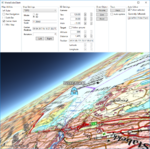
* the map display changes according to selected map template
* the map display changes according to deleted mode


== Sections ==
;The following main topics are handled:


{| class="wikitable"
|-
|
;1. [[Maria_globe_client/Utilising_the_globe_control|Utilising the globe control]]
|
[[File:Globe_First-3D.PNG|150px|link=Maria_globe_client/Utilising_the_globe_control]]
|-
|-
|  
|  
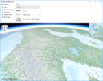
[[File:Map_Pref_2D.PNG|500px|Preferred map, 2D]] <br>
;2. [[Maria_globe_client/Map_interaction|Map interaction]]
Preferred map, 2D
|
[[File:Map_Pref_3D.PNG|150px|link=Maria_globe_client/Map_interaction]]
|-
|  
|  
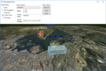
[[File:Map_Pref_3D.PNG|500px|Preferred map, 3D]] <br>
;3. [[Maria_globe_client/Draw_object_interaction|Draw object interaction]]
Preferred map, 3D
|
[[File:DrawObjects_3D.PNG|150px|link=Maria_globe_client/Draw_object_interaction]]
|-
|-
|
;4. [[Maria_globe_client/Track_interaction|Track interaction]]
|
|
[[File:Map_Alt_2D.PNG|500px|Another map, 2D]] <br>
[[File:Track_3D.PNG|150px|link=Maria_globe_client/Track_interaction]]
Another map, 2D
|-
|
;5. [[Maria_globe_client/Auto_follow|Auto follow]]
|
|
[[File:Map_Alt_3D.PNG|500px|Another map, 3D]] <br>
[[File:Auto_follow_track_3D.PNG|150px|link=Maria_globe_client/Auto_follow]]
Another map, 3D
|}
 
=== Draw object interaction ===
 
In this section, we will add and update different draw objects, and see how they are presented in the 2D and 3D modes.
 
==== Adding draw object layer and draw object view model ====
 
To be able to display draw object, we need to include a draw object layer in the globe client.
 
First, add a view model class, '''''DrawObjectViewModel''''', to handle the draw object interaction:
 
* Inheriting '''''ViewModelBase'''''
* Add a constructor taking a draw layer object as input
* Create and implement event handlers for:
** '''''LayerInitialized'''''
** '''''ServiceConnected'''''
 
<source lang="C#">
public class DrawObjectViewModel : ViewModelBase
{
    private IMariaDrawObjectLayer _drawObjectLayer;
    private IMariaService _drawObjectService;
 
    public DrawObjectViewModel(DrawObjectLayer drawObjectLayer)
    {
        _drawObjectLayer = drawObjectLayer;
        _drawObjectLayer.LayerInitialized += DrawObjectLayer_LayerInitialized;
        _drawObjectLayer.ServiceConnected += DrawObjectLayer_ServiceConnected;
    }
 
    private void DrawObjectLayer_LayerInitialized()
    {
        _drawObjectService = new MariaService(
            "DrawObjectService",
            "http://localhost:9008/drawobjects",
            BindingType.BasicHttp);
 
        _drawObjectLayer.DrawObjectServices = new ObservableCollection<IMariaService> { _drawObjectService };
 
        _drawObjectLayer.CreateDrawObjectList("local", true);
    }
 
    private void DrawObjectLayer_ServiceConnected(object sender, MariaServiceEventArgs args)
    {
        _drawObjectLayer.ActiveDrawObjectService = _drawObjectLayer.DrawObjectServices[0];
 
        _drawObjectLayer.CreateDrawObjectList("test", false);
        _drawObjectLayer.ActiveDrawObjectList = "test";
    }
}
</source>
 
In the '''''MainViewModel''''', add a draw object layer field, and in the constructor, add creation of the layer and '''''DrawObjectViewModel'''''  and add the layer to the '''''Layers''''' list.
 
<source lang="C#">
...
public DrawObjectViewModel DrawObjectViewModel { get; private set; }
 
public MainViewModel()
{
    ...
    DrawObjectLayerFactory = new DrawObjectLayerFactory();
    _drawObjectLayer = new DrawObjectLayer(GlobeMapManager, DrawObjectLayerFactory, true)
        { InitializeCreationWorkflows = true };
    DrawObjectViewModel = new DrawObjectViewModel(_drawObjectLayer);
    Layers.Add(_drawObjectLayer);
}
...
</source>
 
==== Draw object utilities ====
 
Add the following GUI elements to your main window:
* Button for adding/updating a volume object.
* Button for adding/updating a line object.
* Button for adding/updating a point object.
 
 
The XAML could look something like this:
 
<source lang="xml">
...
<GroupBox Header="Draw Object" >
    <StackPanel VerticalAlignment="Top">
        <Button Margin="3"                       
                Content="Volume"
                Command="{Binding VolumeTestCmd}"/>
        <Button Margin="3"                       
                Content="Line"
                Command="{Binding LineTestCmd}"/>
        <Button Margin="3"                       
                Content="Point"
                Command="{Binding PointTestCmd}"/>   
    </StackPanel>
</GroupBox>
...
</source>
 
Implement command handlers for the draw object utilities in the '''''MainViewModel''''':
 
<source lang="C#">
...
public ICommand VolumeTestCmd { get { return new DelegateCommand(DrawObjectViewModel.CreateOrUpdateVolumeObject); } }
public ICommand LineTestCmd { get { return new DelegateCommand(DrawObjectViewModel.CreateOrUpdateLineObject); } }
public ICommand PointTestCmd { get { return new DelegateCommand(DrawObjectViewModel.CreateOrUpdatePointObject); } }
...
</source>
 
Implement the command handler delegates in the '''''DrawObjectViewModel'''''.
 
<source lang="C#">
...
public void CreateOrUpdatePointObject(object obj)
{
    var pos = RandomProvider.GetRandomPosition(_drawObjectLayer.GeoContext.Viewport.GeoRect);
 
    var altitude = RandomProvider.GetRandomInt(1, 5) * 500.0;
 
    var pointObject = _drawObjectLayer.DrawObjectFactory.CreateTacticalGraphic("STBOPS.OPN.HJKG.APL");
    pointObject.TacticalDataFields.StandardIdentity = StandardIdentity.Hostile;
    pointObject.TacticalDataFields.Name = "Globe-Point";
    pointObject.Id = new ItemId("local", "Globe-Point");
 
    pointObject.Points[0] = new GeoPoint() { Latitude = pos.Lat, Longitude = pos.Lon, Altitude = altitude };
    _drawObjectLayer.UpdateStore(pointObject);
}
 
public void CreateOrUpdateVolumeObject(object obj)
{
 
    var volumeObject = _drawObjectLayer.DrawObjectFactory.CreateTacticalGraphic("TACGRP.FSUPP.ARS.C2ARS.ACA.IRR");
    volumeObject.TacticalDataFields.StandardIdentity = StandardIdentity.Friendly;
    volumeObject.Id = new ItemId("local", "Globe-Volume");
 
    var pos = RandomProvider.GetRandomPosition(_drawObjectLayer.GeoContext.Viewport.GeoRect, 0.8);
    var factorLat = _drawObjectLayer.GeoContext.Viewport.GeoRect.DeltaLat * RandomProvider.GetRandomDouble(0.05, 0.1);
    var factorLon = _drawObjectLayer.GeoContext.Viewport.GeoRect.DeltaLon * RandomProvider.GetRandomDouble(0.05, 0.1);
 
    volumeObject.Points = new GeoPoint[] {
        new GeoPoint() { Latitude = pos.Lat + factorLat, Longitude = pos.Lon + factorLon },
        new GeoPoint() { Latitude = pos.Lat + factorLat, Longitude = pos.Lon - factorLon },
        new GeoPoint() { Latitude = pos.Lat - factorLat, Longitude = pos.Lon - factorLon },
        new GeoPoint() { Latitude = pos.Lat - factorLat, Longitude = pos.Lon + factorLon },
    };
 
    _drawObjectLayer.UpdateStore(volumeObject);
}
 
public void CreateOrUpdateLineObject(object obj)
{
    var lineObject = _drawObjectLayer.DrawObjectFactory.CreatePolyLine(new ItemId("local", "Globe-Line"));
    var pt0 = RandomProvider.GetRandomPosition(_drawObjectLayer.GeoContext.Viewport.GeoRect, 0.5);
    var pt1 = RandomProvider.GetRandomPosition(_drawObjectLayer.GeoContext.Viewport.GeoRect, 0.5);
    var pt2 = RandomProvider.GetRandomPosition(_drawObjectLayer.GeoContext.Viewport.GeoRect, 0.5);
 
    lineObject.Points = new GeoPoint[] {
        new GeoPoint() { Latitude = pt0.Lat, Longitude = pt0.Lon, Altitude = RandomProvider.GetRandomInt(1, 5) * 500.0 },
        new GeoPoint() { Latitude = pt1.Lat, Longitude = pt1.Lon, Altitude = RandomProvider.GetRandomInt(1, 5) * 500.0 },
        new GeoPoint() { Latitude = pt2.Lat, Longitude = pt2.Lon, Altitude = RandomProvider.GetRandomInt(1, 5) * 500.0 },
    };
 
    lineObject.GenericDataFields.LineColor = Colors.Navy;
    var dashStyle = DashStyles.DashDot;
    lineObject.GenericDataFields.LineDashStyle = dashStyle.Dashes.ToList();
    lineObject.GenericDataFields.LineDashStyleOffset = dashStyle.Offset;
    lineObject.GenericDataFields.LineWidth = 6.0;
 
    _drawObjectLayer.UpdateStore(lineObject);
}
...
</source>
 
The '''''RandomProvider''''' class is described in context with [[Map_interaction_client/Track_layer_interaction#Create_tracks| ''Map interaction client, track creation''. ]]
 
==== Draw object styling ====
 
Add a draw object style xml file to your project, and include it as a resource. You can find style xml to use [[Draw_object_style_xml| '''here''']]
 
Add the resource to the draw object layer in the '''''LayerInitialized''''' event handler in '''''DrawObjectViewModel'''''.
 
<source lang="C#">
...
private void DrawObjectLayer_LayerInitialized()
{
    _drawObjectLayer.StyleXml = Properties.Resources.DrawObjectStyle;
...
</source>
 
==== Running with draw object interaction ====
 
Running your application, observe the following:
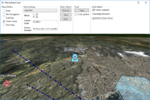
* Pressing the draw object buttons, draw objects created / moved around in the map area.
*
 
{| class="wikitable"
|-
|-
|  
|  
[[File:Map_Pref_2D.PNG|500px|Preferred map, 2D]] <br>
;6. [[Maria_globe_client/Advanced_map_settings|Advanced map settings]]
Draw objects in map, 2D
|
|  
[[File:3D_Set_P15_Y120_R30_af.png|150px|link=Maria_globe_client/Advanced_map_settings]]
[[File:Map_Pref_3D.PNG|500px|Preferred map, 3D]] <br>
Draw objects in map, 3D
|}
|}


=== Track interaction ===


=== Autofollow ===
 
=== Monitoring service connections ===
[[Category:Creating applications]]

Latest revision as of 13:58, 28 October 2019

Maria Globe Client

These pages describe how to create a Maria GDK map client utilising MariaGlobeMapControl with 2D and 3D visualisation of map, tracks and draw objects.

General

Note
  • You will need to include the TPG.MariaGDK3D NuGet package. (Currently available Teleplan Globe internal only)
For more info, see Loading Maria GDK, NuGet Packages
  • Sample code is found in the MariaGlobeClient project, in the Sample Projects solution.
  • Note that the sample code is specifying the service connections in code, and not by app.config.
  • For general troubleshooting, see Development troubleshooting

Sections

The following main topics are handled
1. Utilising the globe control

Globe First-3D.PNG

2. Map interaction

Map Pref 3D.PNG

3. Draw object interaction

DrawObjects 3D.PNG

4. Track interaction

Track 3D.PNG

5. Auto follow

Auto follow track 3D.PNG

6. Advanced map settings

3D Set P15 Y120 R30 af.png