Maria globe client
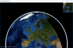
This page describes how to create a Maria GDK map client utilising MariaGlobeMapControl with 2D and 3D visualisation of map, tracks and draw objects.

General
This page is under construction!
- Note
-
- You will need to include the TPG.Maria.MariaGlobeMapControl NuGet package (Currently available Teleplan Globe internal only)
- Sample code is found in the MariaGlobeClient project, in the Sample Projects solution.
- Note that the sample code is specifying the service connections in code, and not by app.config.
- For general troubleshooting, see Development troubleshooting
|
| |
|
| |
|
| |
|
| |
|
| |
|
|
Advanced map settings
Map rotation
As default, 2D maps are displayed with north up, but you may rotate the map by modifying the map layer rotation parameter - GeoContext.RotateValue.
Add the following components:
- Text box to display the current rotation value
- Two buttons, for right (clockwise) add left (counter clockwise).
Add the following to your Main Window XAML:
. . .
<Label Grid.Row="4" Grid.Column="0"
       Content="Rotation" FontWeight="DemiBold"/>

<TextBox Grid.Row="4" Grid.Column="1" Margin="3"
         Text="{Binding MapViewModel.Rotation}" TextAlignment="Right" />

<StackPanel  Grid.Row="5" Grid.Column="1" Orientation="Horizontal"
             VerticalAlignment="Center" HorizontalAlignment="Center">
    <RepeatButton Margin="3" Width="50"
                  Content="Left"
                  Command="{Binding MapViewModel.RotateLeftCmnd}"/>
    <RepeatButton Margin="3" Width="50"
                  Content="Right"
                  Command="{Binding MapViewModel.RotateRightCmnd}"/>
</StackPanel>
. . .
And implement corresponding properties and command handlers in MapViewModel:
. . .
public ICommand RotateLeftCmnd { get { return new DelegateCommand(OnRotateLeft); } }
public ICommand RotateRightCmnd { get { return new DelegateCommand(OnRotateRight); } }

private void OnRotateLeft(object obj)
{
    Rotation += 1;
}

private void OnRotateRight(object obj)
{
    Rotation -= 1;
}

public int Rotation
{
    get { return _mapLayer.GeoContext != null ? (int)_mapLayer.GeoContext.RotateValue : 0; }
    set
    {
        _mapLayer.GeoContext.RotateValue = value;
        NotifyPropertyChanged(() => Rotation);
    }
}
. . .
Pressing the buttons, the map is rotated, and the rotation display is updated accordingly.

3D map settings
3D Properties
The Globe Client 3D view is the view from a camera towards a target, specified by the following parameters:
| Description | ||
|---|---|---|
| Camera yaw | Horizontal rotation, degrees - counterclockwise. | 
|
| Camera pitch | Front/back rotation, degrees - counterclockwise | |
| Camera roll | Left/right rotation, degrees - counterclockwise. | |
| Follow ground |
Lock the target altitude is to the elevation of the target position. | |
| Target altitude |
Height above sea level (0-elevation) at target position. Changes are not applicable while:
| |
| Target position |
Latitude and longitude. Changes are not applicable while:
| |
| Target distance | Distance from camera to target. | |
- Note
-
- 3D rotations are not commutative.
- Performing the same rotations in different order will give different results.
Implementation
To visualise how these parameters are connected, add the following elements to your main window:
. . .
<GroupBox Header="3D Settings"
          IsEnabled="{Binding MapViewModel.Is3DMode}" >
    <Grid >
        <Grid.RowDefinitions>
            <RowDefinition Height="Auto" />
            <RowDefinition Height="Auto" />
            <RowDefinition Height="Auto" />
            <RowDefinition Height="Auto" />
            <RowDefinition Height="Auto" />
            <RowDefinition Height="Auto" />
            <RowDefinition Height="Auto" />
            <RowDefinition Height="Auto" />
            <RowDefinition Height="Auto" />
            <RowDefinition Height="Auto" />
        </Grid.RowDefinitions>
        <Grid.ColumnDefinitions>
            <ColumnDefinition Width="Auto"/>
            <ColumnDefinition Width="Auto"/>
            <ColumnDefinition Width="Auto"/>
            <ColumnDefinition Width="Auto"/>
        </Grid.ColumnDefinitions>

        <Label Grid.Row="0" Grid.Column="0" Grid.ColumnSpan="4"
               Content="Camera" FontWeight="DemiBold" />

        <Label Grid.Row="1" Grid.Column="0"
               Content="Yaw"   />
        <TextBox Grid.Row="1" Grid.Column="1" Margin="3" Width="60"
                 Text="{Binding MapViewModel.CameraYaw, StringFormat=N2}" TextAlignment="Right"
                 IsReadOnly="True"/>
        <RepeatButton Grid.Row="1" Grid.Column="2" Width="12" Margin="3" HorizontalAlignment="Center"
                      Content="+"
                      Command="{Binding MapViewModel.IncreaseYawCmnd}"/>
        <RepeatButton Grid.Row="1" Grid.Column="3" Width="12" Margin="3" HorizontalAlignment="Center"
                      Content="-"
                      Command="{Binding MapViewModel.DecreaseYawCmnd}"/>

        <Label Grid.Row="2" Grid.Column="0"
               Content="Roll" />
        <TextBox Grid.Row="2" Grid.Column="1" Margin="3" Width="60"
                 Text="{Binding MapViewModel.CameraRoll, StringFormat=N2}" TextAlignment="Right"
                 IsReadOnly="True"/>
        <RepeatButton Grid.Row="2" Grid.Column="2" Width="12" Margin="3" HorizontalAlignment="Center"
                      Content="+"
                      Command="{Binding MapViewModel.IncreaseRollCmnd}"/>
        <RepeatButton Grid.Row="2" Grid.Column="3" Width="12" Margin="3" HorizontalAlignment="Center"
                      Content="-"
                      Command="{Binding MapViewModel.DecreaseRollCmnd}"/>

        <Label Grid.Row="3" Grid.Column="0"
               Content="Pitch" />
        <TextBox Grid.Row="3" Grid.Column="1" Margin="3" Width="60"
                 Text="{Binding MapViewModel.CameraPitch, StringFormat=N2}" TextAlignment="Right"
                 IsReadOnly="True"/>
        <RepeatButton Grid.Row="3" Grid.Column="2" Width="12" Margin="3" HorizontalAlignment="Center"
                      Content="+"
                      Command="{Binding MapViewModel.IncreasePitchCmnd}"/>
        <RepeatButton Grid.Row="3" Grid.Column="3" Width="12" Margin="3" HorizontalAlignment="Center"
                      Content="-"
                      Command="{Binding MapViewModel.DecreasePitchCmnd}"/>

        <Label Grid.Row="4" Grid.Column="0"
               Content="Target" FontWeight="DemiBold" />
        <CheckBox Grid.Row="4"  Grid.Column="1" Grid.ColumnSpan="3" VerticalAlignment="Center" Margin="3"
                  Content="Follow ground"
                  IsChecked="{Binding MapViewModel.FollowGround}"/>

        <Label Grid.Row="5" Grid.Column="0"
               Content="Altitude" />
        <TextBox Grid.Row="5" Grid.Column="1" Margin="3" Width="60"
                 Text="{Binding MapViewModel.TargetAltitude, StringFormat=N0}" TextAlignment="Right"
                 IsReadOnly="True"/>
        <RepeatButton Grid.Row="5" Grid.Column="2" Width="12" Margin="3" HorizontalAlignment="Center"
                      Content="+"
                      Command="{Binding MapViewModel.IncreaseTargetAltitudeCmnd}"/>
        <RepeatButton Grid.Row="5" Grid.Column="3" Width="12" Margin="3" HorizontalAlignment="Center"
                      Content="-"
                      Command="{Binding MapViewModel.DecreaseTargetAltitudeCmnd}"/>

        <Label Grid.Row="6" Grid.Column="0"
               Content="Distance" />
        <TextBox Grid.Row="6" Grid.Column="1" Margin="3" Width="60"
                 Text="{Binding MapViewModel.TargetDistance, StringFormat=N0}" TextAlignment="Right"
                 IsReadOnly="True"/>
        <RepeatButton Grid.Row="6" Grid.Column="2" Width="12" Margin="3" HorizontalAlignment="Center"
                      Content="+"
                      Command="{Binding MapViewModel.IncreaseTargetDistanceCmnd}"/>
        <RepeatButton Grid.Row="6" Grid.Column="3" Width="12" Margin="3" HorizontalAlignment="Center"
                      Content="-"
                      Command="{Binding MapViewModel.DecreaseTargetDistanceCmnd}"/>

        <Label Grid.Row="7" Grid.Column="0"
               Content="Position" />
        <TextBox Grid.Row="7" Grid.Column="1" Grid.ColumnSpan="3" Margin="3"
                 Text="{Binding MapViewModel.TargetPosText, Mode=OneWay}" TextAlignment="Right"
                 IsReadOnly="True"/>
        <Label Grid.Row="8" Grid.Column="1"
               Content="Latitude"/>
        <RepeatButton Grid.Row="8" Grid.Column="2" Width="12" Margin="3" HorizontalAlignment="Center"
                      Content="+"
                      Command="{Binding MapViewModel.IncreaseTargetPosLatCmnd}"/>
        <RepeatButton Grid.Row="8" Grid.Column="3" Width="12" Margin="3" HorizontalAlignment="Center"
                      Content="-"
                      Command="{Binding MapViewModel.DecreaseTargetPosLatCmnd}"/>

        <Label Grid.Row="9" Grid.Column="1"
               Content="Longitude"/>
        <RepeatButton Grid.Row="9" Grid.Column="2" Width="12" Margin="3" HorizontalAlignment="Center"
                      Content="+"
                      Command="{Binding MapViewModel.IncreaseTargetPosLonCmnd}"/>
        <RepeatButton Grid.Row="9" Grid.Column="3" Width="12" Margin="3" HorizontalAlignment="Center"
                      Content="-"
                      Command="{Binding MapViewModel.DecreaseTargetPosLonCmnd}"/>
    </Grid>
</GroupBox>
. . .
And add necessary command handlers and properties to MapViewModel
. . .
public ICommand IncreaseYawCmnd { get { return new DelegateCommand(OnIncreaseCameraYaw); } }
public ICommand DecreaseYawCmnd { get { return new DelegateCommand(OnDecreaseCameraYaw); } }

public ICommand IncreaseRollCmnd { get { return new DelegateCommand(OnIncreaseCameraRoll); } }
public ICommand DecreaseRollCmnd { get { return new DelegateCommand(OnDecreaseCameraRoll); } }

public ICommand IncreasePitchCmnd { get { return new DelegateCommand(OnIncreaseCameraPitch); } }
public ICommand DecreasePitchCmnd { get { return new DelegateCommand(OnDecreaseCameraPitch); } }

public ICommand IncreaseTargetDistanceCmnd { get { return new DelegateCommand(OnIncreaseTargetDistance); } }
public ICommand DecreaseTargetDistanceCmnd { get { return new DelegateCommand(OnDecreaseTargetDistance); } }

public ICommand IncreaseTargetAltitudeCmnd { get { return new DelegateCommand(OnIncreaseTargetAlttitude, CanModTargetAltitude); } }
public ICommand DecreaseTargetAltitudeCmnd { get { return new DelegateCommand(OnDecreaseTargetAltitide, CanModTargetAltitude); } }

public ICommand IncreaseTargetPosLatCmnd { get { return new DelegateCommand(OnIncreaseTargetPosLat, CanModTargetPosition); } }
public ICommand DecreaseTargetPosLatCmnd { get { return new DelegateCommand(OnDecreaseTargetPosLat, CanModTargetPosition); } }
public ICommand IncreaseTargetPosLonCmnd { get { return new DelegateCommand(OnIncreaseTargetPosLon, CanModTargetPosition); } }
public ICommand DecreaseTargetPosLonCmnd { get { return new DelegateCommand(OnDecreaseTargetPosLon, CanModTargetPosition); } }

public bool Autofollow
{
    get { return _autoFollow; }
    set
    {
        _autoFollow = value;

        RefreshTargetAndCameraValues();
    }
}

private void OnIncreaseCameraYaw(object obj) { CameraYaw += 1; }
private void OnDecreaseCameraYaw(object obj) { CameraYaw -= 1; }

private void OnIncreaseCameraRoll(object obj) { CameraRoll += 1; }
private void OnDecreaseCameraRoll(object obj) { CameraRoll -= 1; }

private void OnIncreaseCameraPitch(object obj) { CameraPitch += 1; }
private void OnDecreaseCameraPitch(object obj) { CameraPitch -= 1; }

private void OnIncreaseTargetAlttitude(object obj) { TargetAltitude += 10; }
private void OnDecreaseTargetAltitide(object obj) { TargetAltitude -= 10; }

private void OnIncreaseTargetPosLat(object obj) { TargetPos = new GeoPos(TargetPos.Lat + (1.0 / (60 * 60)), TargetPos.Lon ); }
private void OnDecreaseTargetPosLat(object obj) { TargetPos = new GeoPos(TargetPos.Lat - (1.0 / (60 * 60)), TargetPos.Lon ); }
private void OnIncreaseTargetPosLon(object obj) { TargetPos = new GeoPos(TargetPos.Lat, TargetPos.Lon + (1.0 / (60 * 60))); }
private void OnDecreaseTargetPosLon(object obj) { TargetPos = new GeoPos(TargetPos.Lat, TargetPos.Lon - (1.0 / (60 * 60))); }

private bool CanModTargetAltitude(object obj) { return !FollowGround && !Autofollow; }
private bool CanModTargetPosition(object obj) { return !Autofollow; }

private void OnIncreaseTargetDistance(object obj) { TargetDistance += 10; }
private void OnDecreaseTargetDistance(object obj) { TargetDistance -= 10; }

public double CameraYaw
{
    get
    {
        if (GlobeMapViewModel?.Globe3DViewModel?.CameraControl != null)
            return GlobeMapViewModel.Globe3DViewModel.CameraControl.Yaw;
        return 0;
    }
    set
    {
        if (GlobeMapViewModel?.Globe3DViewModel?.CameraControl != null)
        {
            GlobeMapViewModel.Globe3DViewModel.CameraControl.Yaw = value;
        }

        NotifyPropertyChanged(() => CameraYaw);
    }
}

public double CameraRoll
{
    get
    {
        if (GlobeMapViewModel?.Globe3DViewModel?.CameraControl != null)
            return GlobeMapViewModel.Globe3DViewModel.CameraControl.Roll;
        return 0;
    }
    set
    {
        if (GlobeMapViewModel?.Globe3DViewModel?.CameraControl != null)
        {
            GlobeMapViewModel.Globe3DViewModel.CameraControl.Roll = value;
        }

        NotifyPropertyChanged(() => CameraRoll);
    }
}

public double CameraPitch
{
    get
    {
        if (GlobeMapViewModel?.Globe3DViewModel?.CameraControl != null)
            return GlobeMapViewModel.Globe3DViewModel.CameraControl.Pitch;
        return 0;
    }
    set
    {
        if (GlobeMapViewModel?.Globe3DViewModel?.CameraControl != null)
        {
            GlobeMapViewModel.Globe3DViewModel.CameraControl.Pitch = value;
        }

        NotifyPropertyChanged(() => CameraPitch);
    }
}

public string TargetPosText { get { return TargetPos.ToString(); } }

public GeoPos TargetPos
{
    get
    {
        if (GlobeMapViewModel?.Globe3DViewModel?.CameraControl != null)
            return GlobeMapViewModel.Globe3DViewModel.CameraControl.TargetPos;

        return GeoPos.InvalidPos;
    }
    set
    {
        if (GlobeMapViewModel?.Globe3DViewModel?.CameraControl != null)
        {
            GlobeMapViewModel.Globe3DViewModel.CameraControl.TargetPos = value;
        }

        RefreshTargetAndCameraValues();
    }
}

public double TargetAltitude
{
    get
    {
        if (GlobeMapViewModel?.Globe3DViewModel?.CameraControl != null)
            return GlobeMapViewModel.Globe3DViewModel.CameraControl.TargetAltitude;
        return 0;
    }
    set
    {
        if (GlobeMapViewModel?.Globe3DViewModel?.CameraControl != null)
        {
            GlobeMapViewModel.Globe3DViewModel.CameraControl.TargetAltitude = value;
        }

        NotifyPropertyChanged(() => TargetAltitude);
    }
}

public bool FollowGround
{
    get
    {
        if (GlobeMapViewModel?.Globe3DViewModel?.CameraControl != null)
            return GlobeMapViewModel.Globe3DViewModel.CameraControl.FollowGround;
        return true;
    }
    set
    {
        if (GlobeMapViewModel?.Globe3DViewModel?.CameraControl != null)
        {
            GlobeMapViewModel.Globe3DViewModel.CameraControl.FollowGround = value;
        }

        NotifyPropertyChanged(() => FollowGround);
    }
}

public double TargetDistance
{
    get
    {
        if (GlobeMapViewModel?.Globe3DViewModel?.CameraControl != null)
            return GlobeMapViewModel.Globe3DViewModel.CameraControl.TargetDistance;
        return 0;
    }
    set
    {
        if (GlobeMapViewModel?.Globe3DViewModel?.CameraControl != null)
        {
            GlobeMapViewModel.Globe3DViewModel.CameraControl.TargetDistance = value;
        }

        NotifyPropertyChanged(() => TargetDistance);
    }
}
. . .
private void RefreshTargetAndCameraValues()
{
    NotifyPropertyChanged(() => FollowGround);
    NotifyPropertyChanged(() => Autofollow);

    NotifyPropertyChanged(() => CameraPitch);
    NotifyPropertyChanged(() => CameraRoll);
    NotifyPropertyChanged(() => CameraYaw);

    NotifyPropertyChanged(() => TargetAltitude);
    NotifyPropertyChanged(() => TargetPos);
    NotifyPropertyChanged(() => TargetPosText);
    NotifyPropertyChanged(() => TargetDistance);
}
. . .
... and update MapViewModel.Autofollow when auto follow has changed in MainViewModel!
. . .
public bool IsAutoFollowActive
{
   . . .
    set
    {
        if (!(value && GlobeMapViewModel.AutoFollow.FollowSelectedItem()))
            GlobeMapViewModel.AutoFollow.TargetItem = null;

        MapViewModel.Autofollow = IsAutoFollowActive;
        NotifyPropertyChanged(() => IsAutoFollowActive);
        NotifyPropertyChanged(() => AutoFollowItemName);
    }
}
. . .
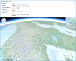
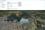
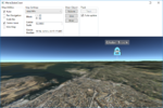
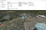
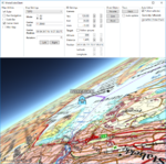
Running with display of 3D settings
Running the Globe client in 3D mode, altering the 3D parameters will give results like this:
|
|
|
|
|
|
|
|
|


